
Brighton Neighbors: Source Check
For a block around a Brighton address, each source answers a narrow question. The map identifies land around the target. The assessment roll identifies an owner-of-record and the tax mailing contact. A recorded deed supplies a chain of land transactions. Those labels cannot be blended into a claim that every named person lives there. The most reliable starting point is the address, then the parcel number, also called an SBL or tax-map identifier. Keep the search date with every result because rolls and map layers change.
| Source | What It Shows About a Block | Access |
|---|---|---|
| GIS parcel viewer | Adjacent polygons, street addresses, SBLs, ZIP and district layers | Public viewer; identify and click each parcel. |
| Assessment roll | Owner-of-record, mailing and situs addresses, class, value and districts | Public Brighton roll and county property portal; year-specific. |
| Deed index | Recorded ownership sequence, parties, document date and legal description | SearchIQS index, Clerk terminal, or older books and microfilm. |
| Zoning and board packets | Address, applicant, site plan, public comments, variance, or decision | Town site when posted; request an older file from Building and Planning. |
| Voter lookup | A match for a known registered voter and election information | State or county form, not a block-wide browse screen. |
| Associations and local history | Community geography, events, historical occupants and civic notices | Organization contacts, library collections, scans and microfilm. |
A parcel owner can be a person, trust, estate, business, or mailing contact elsewhere. The tax roll may also show exemption codes, but those do not establish every member of a household. When the question is historical, a street directory or newspaper notice can be useful, yet it records an occupant or event in a particular period rather than a present-day household. Brighton neighbors are best understood as separate public roles, not as a ready-made roster.
Mapping Parcels for Brighton Neighbors
Monroe County Parcel Viewer is the practical map bridge for a Brighton block. Search by address or zoom to the street, choose the identify tool on the target polygon, and open its linked property information. The map can display parcels, municipal boundaries, ZIP codes, centerlines, imagery, buildings, parks, schools, and district layers. A corner lot can touch another street, ZIP, or municipality, so turn on the boundary and centerline layers before treating it as part of one simple block.
Once the map loads, each surrounding polygon needs its own identify click. The public parcel service supports address and parcel-field queries, but its visible fields, including COUNTYSBL and PARCELADDRESS, are map data rather than a household list.
- Enter the target address in the Parcel Viewer, select its polygon, and record the street address, SBL, municipality, and property-report link.
- Pan or zoom one parcel outward. Identify every touching polygon, including a corner parcel that faces a different road.
- Open the county property report or Brighton final roll for each SBL. Label the result as owner-of-record, tax mailing contact, or situs property.
- Use a recorded party name and legal description in the deed index only when a title-history question remains. Preserve the deed date and document reference.
This address-to-parcel flow stays close to the immediate block. A search that needs every address along a named road should use the fuller Brighton street directory process instead of treating a small map view as a street-wide record chain.
Brighton Neighbors: Parcel Records
The Monroe County Real Property portal and Brighton assessment records supply the detail behind a selected polygon. Search modes can use an owner name, street address, parcel or SBL, municipality, tax year, and sometimes ZIP. Exact labels can differ by portal mode. A parcel is a defined piece of land in the tax system; its situs is the physical property location. Neither term identifies every person connected with an address.
| Current owner’s address | Where tax correspondence goes. It may be outside Brighton and is not proof of physical presence at the parcel. |
|---|---|
| Property location and class | The situs and assessment classification used for the roll, useful for keeping nearby parcels distinct. |
| School and special districts | Service or tax geography. These boundaries help explain the block but do not identify households. |
| Deed book or account reference | A bridge to the recorded land trail when the SBL and legal description match. |
Map geometry is refreshed on a recurring weekly or quarterly joining schedule, while assessment data can change more often. Save the report date and final-roll date with a Brighton parcel result. That habit avoids confusing a fresh map boundary with a current ownership conclusion.
Brighton Voter Lookup Limits
New York provides a statewide voter tool and Monroe County provides Lookup My Voter Info. The county form uses street number, street name, ZIP, last name, and date of birth. Its address choices are selected from a dropdown. The statewide form likewise requires a name, date of birth, Monroe County, and the registration address. These are confirmation tools for a known voter, not a way to browse every Brighton neighbor around an address.
| Matched lookup | Can return registration, polling-place, ballot-status, and elected-official information for the person whose details match. |
|---|---|
| Full voter file | Requires an elections-purpose statement under Election Law § 3-103(5) through the state FOIL route or the county board. |
| Confidential voter | A qualifying voter’s separate record is not available for public inspection or copying under Election Law § 5-508. |
Do not infer that a nearby owner is registered, that each household member appears on a voter record, or that a no-match reveals anything about a person. Those claims exceed what the public forms provide.
Note: A matched voter result confirms limited registration information, not a complete list of people connected with a Brighton address.
Brighton Neighbors and Associations
Association sites add community context that a parcel record cannot supply. They can describe a boundary, a history, public events, or a route to participate. They are not member directories. Roselawn Neighborhood Association describes local events and a join-through-group route, while its public material does not publish a resident list.
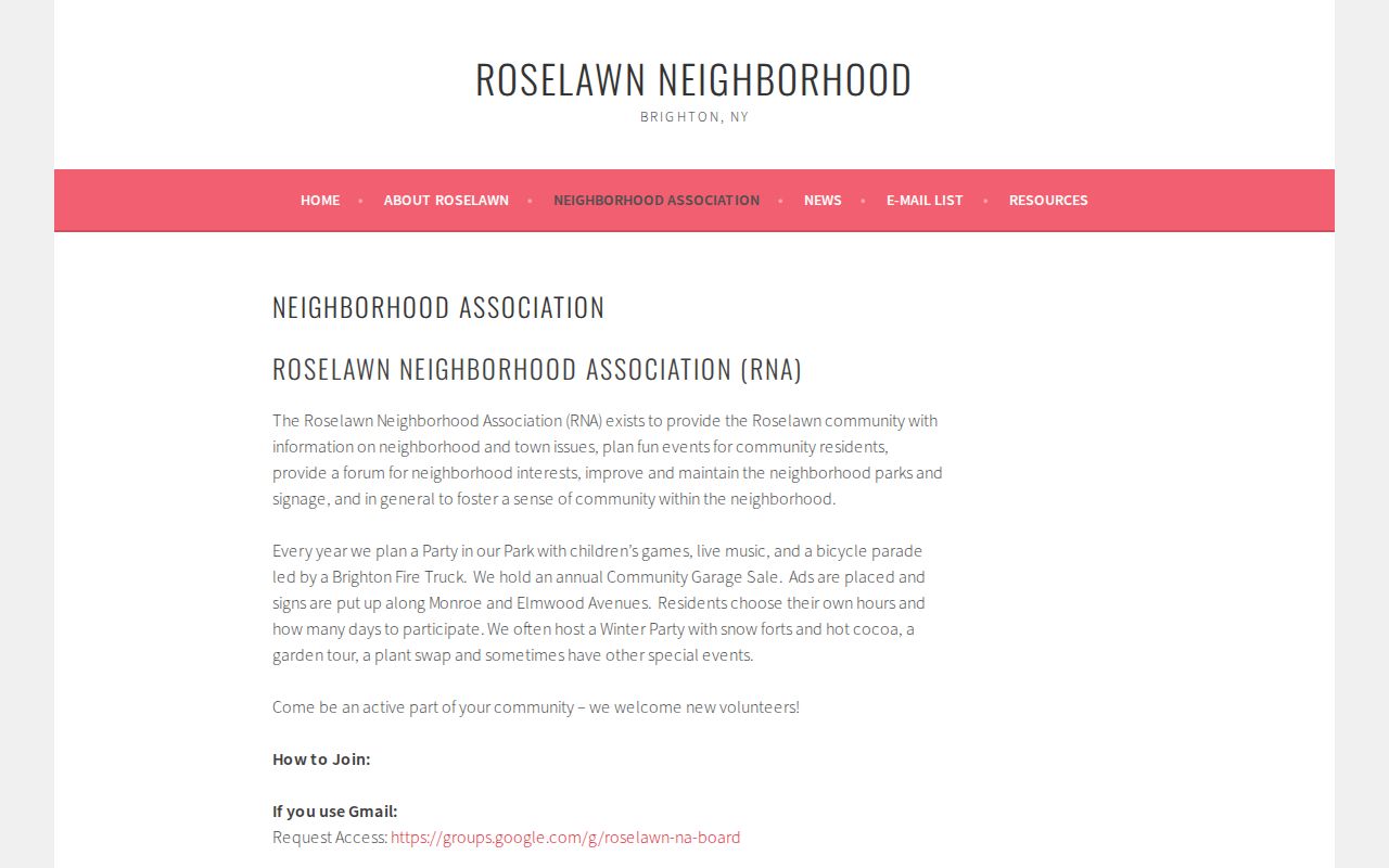
The Roselawn capture shows the association’s neighborhood mission, event information, and access route. It is useful for learning how a community connects, not for identifying or publishing its members.
| Association | Published Brighton context | Publicly supported use |
|---|---|---|
| Meadowbrook | 372 homes; formed in 1931; boundaries include Elmwood, Winton South, Danbury Circle South, Bonnie Brae, and Vernon Place. | Boundary, history, and activity context, not a resident register. |
| Bel-Air Brighton | Local association contact and community material. | Contact route and civic context; no public membership roster located. |
| Kirk/Astor | Town ZBA archive describes about 26 Kirk Drive homes and a similar number on Astor, with roots in the early 1970s. | Historical civic evidence, not confirmation of present membership. |
Browncroft’s Brighton Block Story
Browncroft is the important exception when a neighborhood search crosses Brighton’s northern edge. The Browncroft Neighborhood Association history records a sequence that moved records between custodians: a portion was annexed by Rochester on April 5, 1905, the law was amended on March 25, 1913, and the broader neighborhood entered Rochester at midnight on January 1, 1914. An older address can therefore appear in Town of Brighton material before it appears in Rochester material later.
| Before April 1905 | Start with Brighton and Monroe County records for the applicable address and legal description. |
|---|---|
| 1905 and 1913 changes | Check the exact parcel history and date, because the boundary transition was not one simple event. |
| From January 1, 1914 | Search Rochester materials alongside Monroe County records for later Browncroft history. |
This is a records-custody story, not proof that a current block belongs to the town or city without checking the parcel map. The legal description and municipality field are safer anchors than an old street number alone.
Historical Brighton Neighbors
For a past block, the strongest local trail often runs through the Rochester Public Library Local History and Genealogy Division and Brighton Memorial Library. Rundel holds a city-directory name index with 21,199 names for 1876–1889, an 1872 Beers Atlas index with more than 11,500 property owners, maps, newspapers, directories, and microfilm. The figures show the depth of the regional shelf, but neither index is a present-day Brighton roster.
Brighton Memorial Library’s 2026 local-research program also highlighted digitized runs of Jewish Tidings from 1887–94, The Jewish Ledger from 1924–93, and the Brighton-Pittsford Post from 1943–2015. Search a street, surname, association, or civic event in the relevant era, then test a result against the parcel, directory, or recorded deed. A historical notice can show a connection at a point in time without establishing a current household.
Note: Ask the reference desk which directory or newspaper years are available before treating a gap in a scan as a missing person.
Brighton Neighbors: Record Tools
Official records and commercial neighbor tools do different work. An official map or roll identifies its custodian, scope, and update limits. A commercial tool can merge records from mixed sources, but it may be stale, attach a name to the wrong address, or hide the source trail. Use official Brighton and Monroe County records first when the question is about a parcel, boundary, recorded party, or limited voter confirmation.
| Question | Official record route | Commercial neighbor-tool limit |
|---|---|---|
| Which land touches this address? | GIS polygon, SBL, and boundary layers. | May omit the parcel basis or merge nearby addresses. |
| Who is recorded on the parcel? | Assessment roll and deed index, with owner and party labels kept distinct. | May present a name without its record date or role. |
| What is the community history? | Association material, directories, maps, and library newspapers. | May treat old names or events as current information. |
Do not republish a compiled list as if it were an official block roster. For a factual correction or a missing land record, return to the named custodian, the map, or the library collection that holds the underlying material.
Brighton Neighbors Lookup Limits
A neighborhood search has firm privacy boundaries. Public parcel records do not reveal every household member. Utility and delivery-customer information are not a public block resource. New York DMV information is restricted, and court filings can require redaction of personal identifying details. A mailing address, a map point, or a public party name should never be used to make a claim about someone’s private life.
New York’s Address Confidentiality Program gives qualifying participants a substitute address, mail forwarding, and legal-service acceptance while protecting the actual address. The confidential-voter process likewise keeps qualifying voter records separate from public inspection. When a court item contains sensitive personal information, follow the state courts’ redaction rules rather than copying it into a neighborhood search.
Lawful use. Public records can support local history, civic research, or a genuine personal connection. They never justify watching, harassing, threatening, or exposing anyone.